Company News
Updates from across AirMatrix, including new product developments, case studies, and company milestones that highlight our progress in advancing airspace intelligence and security.

10 / 31 / 2025
City Advancing Road Safety with AI
ƒlo was deployed across Vaughan’s smart city network to detect and manage traffic congestion in real time. By merging radar, optical, and IoT sensor inputs, the system improved situational awareness and enabled faster response to roadway incidents.
Read Case Study

10 / 28 / 2025
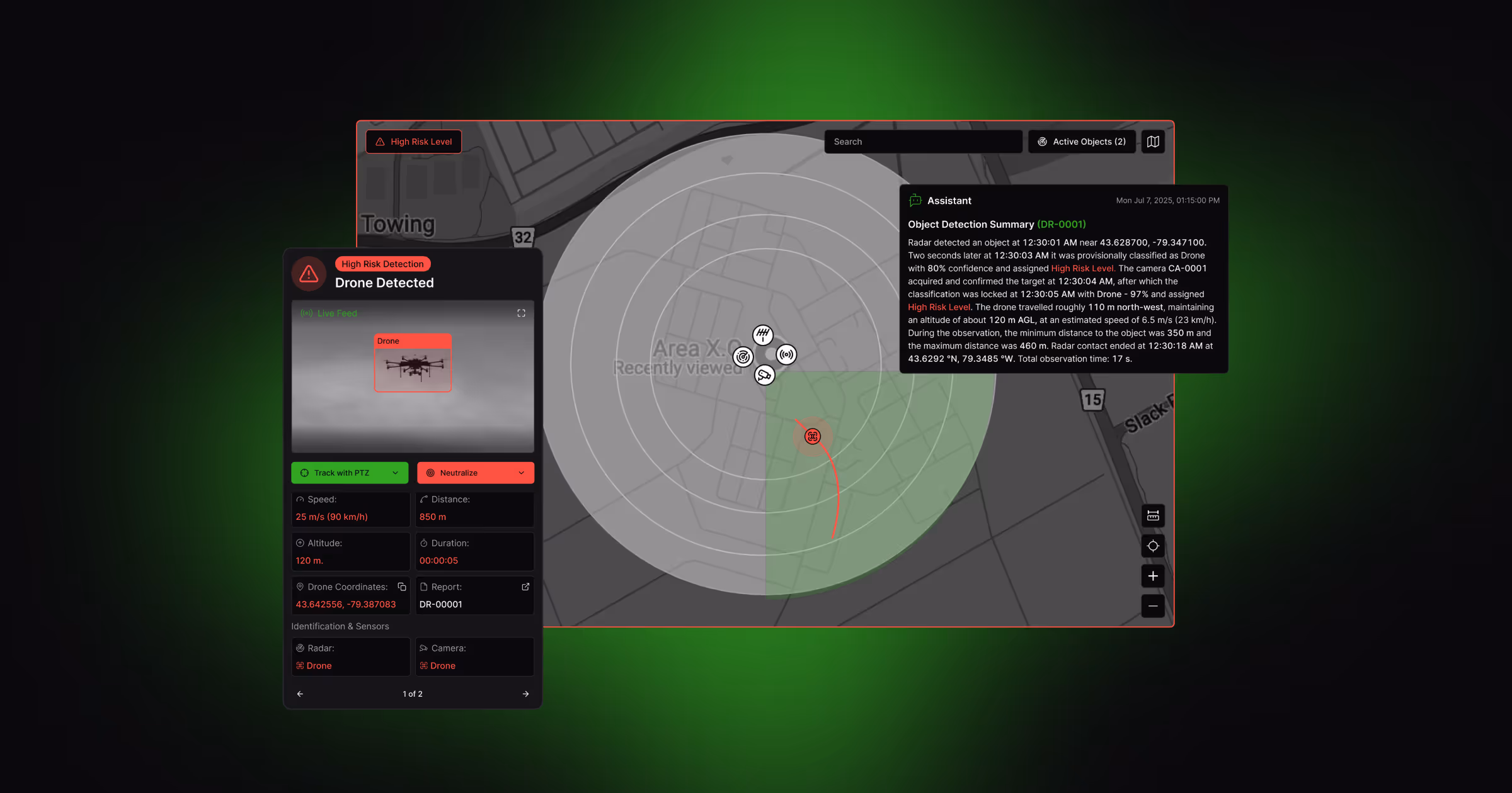
Securing National Airspace with Libra
AirMatrix's Libra AI Command Platform, part of the Innovative Solutions Canada program, aids federal agencies in real-time aerial threat detection and response. It integrates radar, RF, EO/IR, and Remote ID data, enhancing national airspace defense.
Read Case Study
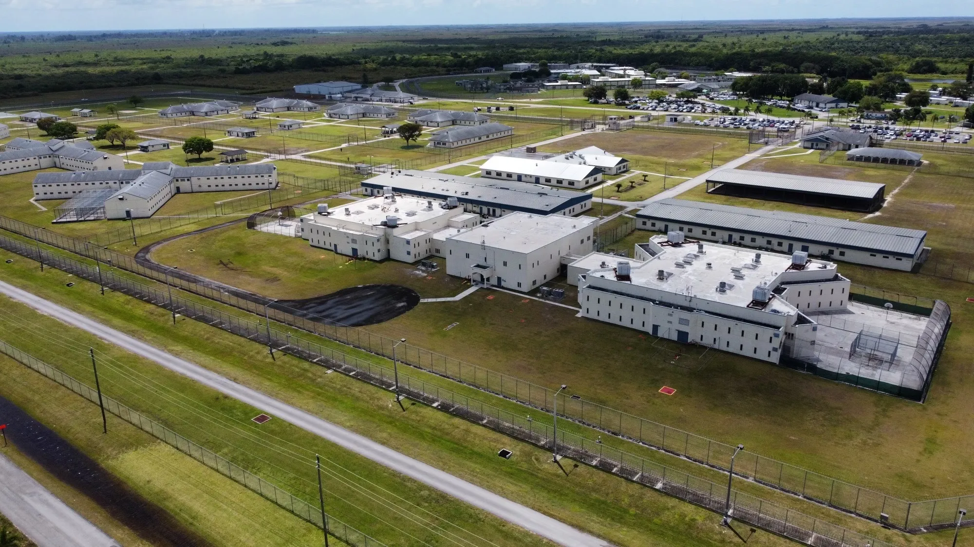
10 / 24 / 2025
Securing Prisons with Libra AI
AirMatrix deployed its Libra AI Command Platform for the Florida Department of Corrections to detect and prevent unauthorized drone activity, enabling continuous monitoring, faster response, and a safer environment across correctional facilities.
Read Case Study
10 / 06 / 2025
Autonomous Object Detection and Classification
AirMatrix platforms now autonomously detect and classify objects using advanced computer vision and sensor fusion, tracking them across various feeds in real time.
Read Product Update
09 / 15 / 2025
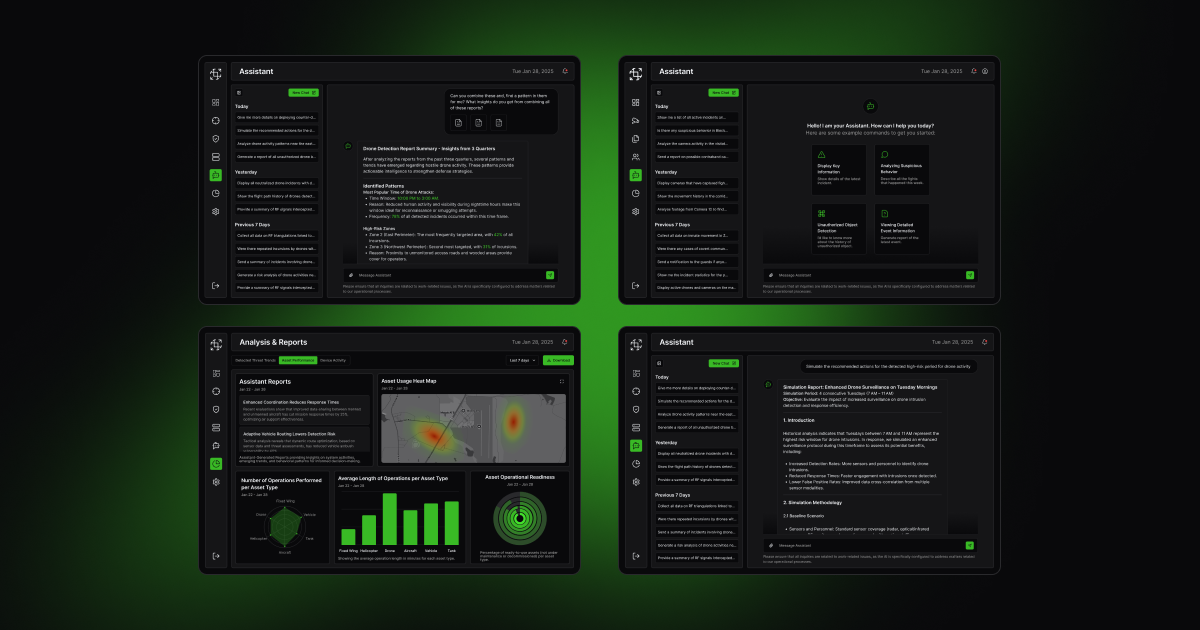
LLM-Powered Intelligence Layer
AirMatrix platforms now feature a proprietary large language model (LLM) within Libra, Aether, and Palladium, enabling AI-driven, conversational data interaction.
Read Product Update