Solution Highlights
ƒlo enhances city operations with real-time mobility intelligence, integrating AI analysis, multi-sensor data fusion, and predictive modeling into a unified operational command system.
Explore ƒlo
ƒlo enhances city operations with real-time mobility intelligence, integrating AI analysis, multi-sensor data fusion, and predictive modeling into a unified operational command system.
.svg)
.svg)


.svg)
.svg)
ƒlo enables smarter, safer, and more coordinated urban operations by merging real-time mobility data, predictive analytics, and AI-assisted monitoring into one unified command layer.
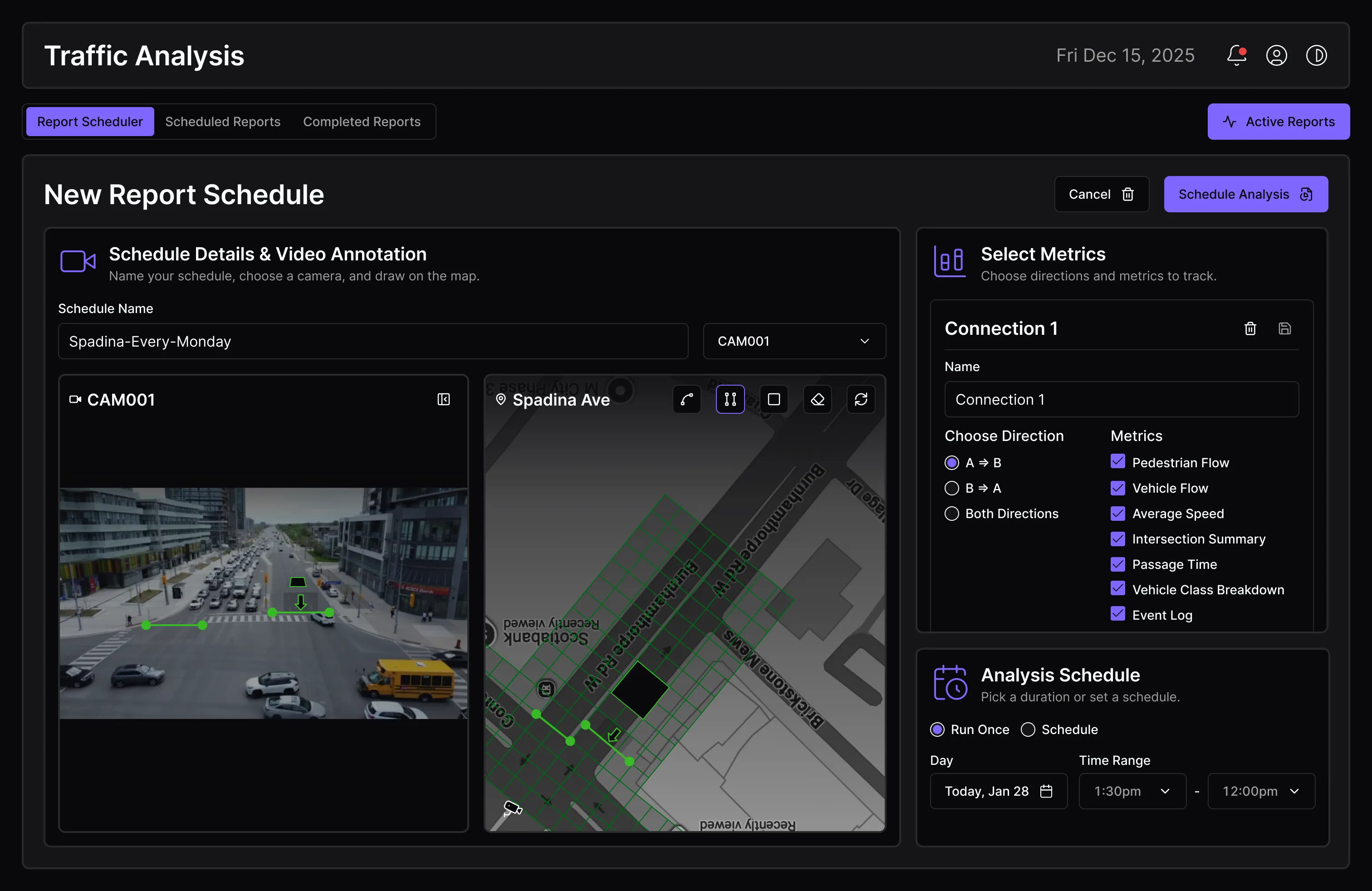
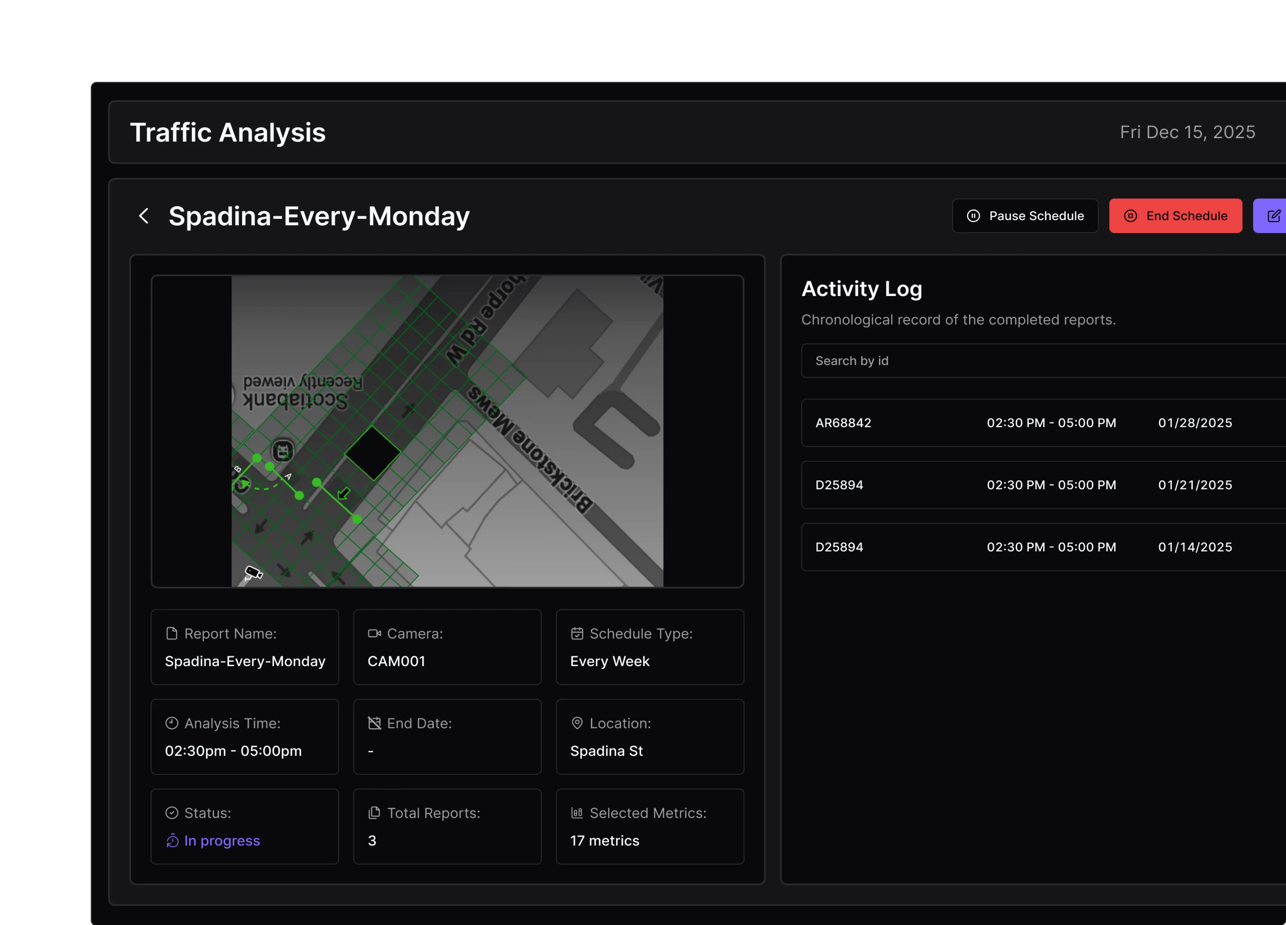
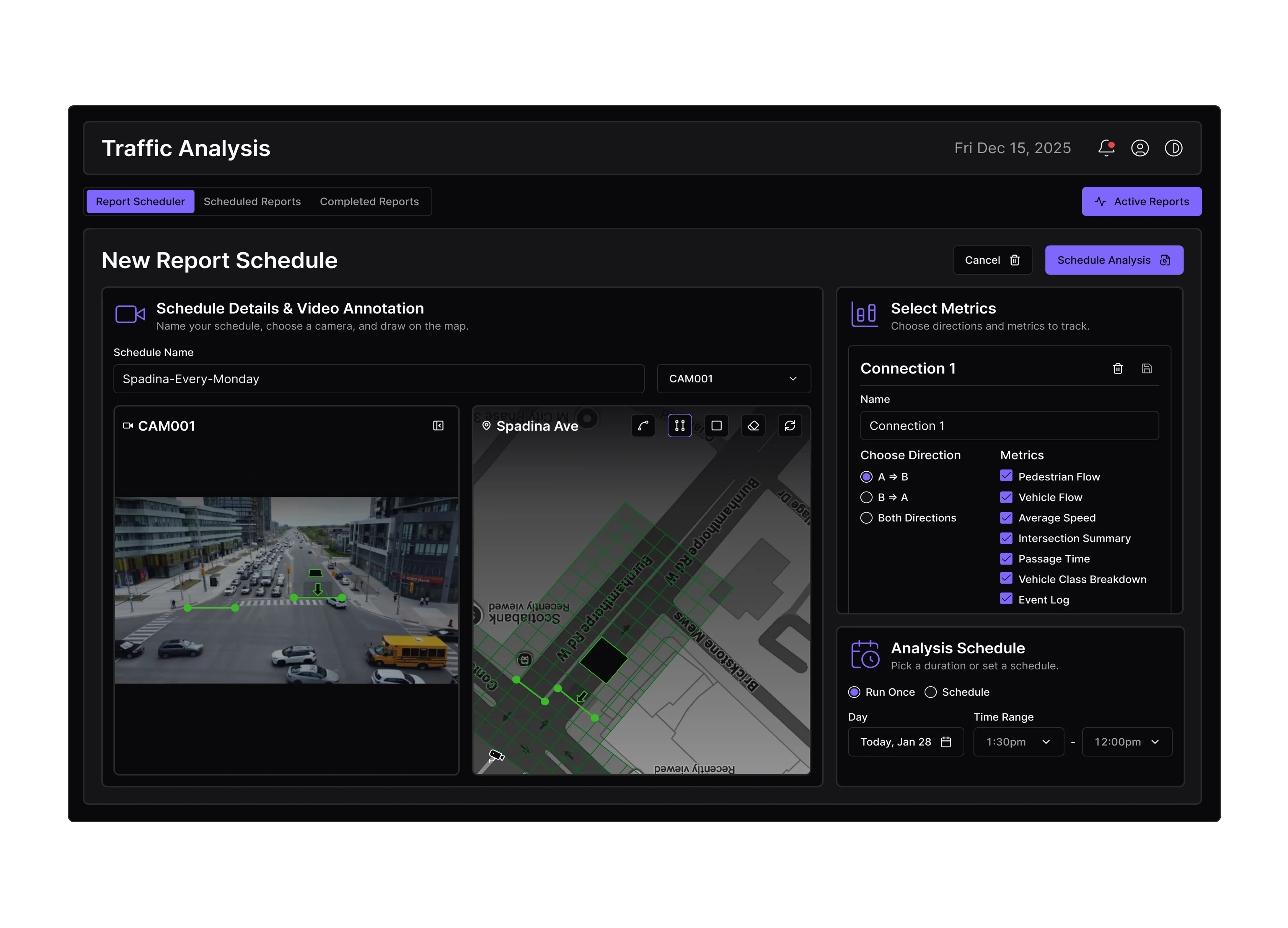
Optimize intersections, highways, and traffic corridors through live data fusion, congestion detection, and adaptive signal control.
Monitor pedestrian and vehicle movement during events to prevent bottlenecks and improve public safety.
Enhance delivery and fleet performance with route optimization and predictive travel-time analysis based on live conditions.
City of Vaughan – Aether Integration
Deployed within Vaughan’s Smart Mobility initiative to enhance traffic awareness and incident response. ƒlo’s AI-driven analytics combined live video, radar, and sensor data for real-time congestion detection and optimized signal coordination.